Saturday, July 19, 2008
Morning came early as we had stayed up late organizing gear for the trip. We picked up the rental car at the Whitehorse aiport, met up with Troy and Annie, and loaded all the gear into car. After a couple short stops in town for last minute supplies, we were on our way.
Under gray skies, we traveled west along the Alaska Highway to Haines Junction. I had been told that there was construction at the Sheep Mountain centre, so I wanted to try to register at the Parks office in Haines Junction. Alana had been given reliable advice to avoid the Slims River due to habituated bear activity. However, our other group members were still hopeful to do the trail and when the Parks employees downplayed the bear issues, we went ahead and signed up.
Now that we were registered, we were not in a panic to reach the Sheep Mountain centre. The bakery across the street came highly recommended, so we stopped for a final meal. I suggest the Hawaiian Pizza with the greatness of onions, zucchini, and peppers in addition to the regular dressings.
A beautiful drive from the town of Haines Junction leads gradually up a wide valley with larger peaks ahead. At Kluane Lake, we waited in line for a pilot car to take us through the blasting zone. We made a left turn past the Parks office down the access road to the warden's cabin and trailhead in 2 km. We loaded packs, locked the car, and were on our way. The time was 4:30.
The trail began as a ATV track through open forest. The first crossing of Sheep Creek happened very early on, but we were able to hop across. Views up onto the Boullion Plateau were inviting. At the rocky Boullion Creek crossing we had to change footwear for the knee-deep ford. After crossing, we followed the gravel wash to pick up the trail again. The toe of the Kaskawulsh Glacier came into view before we re-entered the trees. The trail descended to the valley floor and the going was quick.
We started looking for a suitable place to camp once beyond the windy Boullion dunes. A good spot seemed to be off the trail approximately 100 m uphill on an open plateau, yet trees to either side provided some degree of protection from the heavy winds. We pitched tents and cooked our meals.
After eating, there was some discussion about where to do the dishes. Alana and I felt the main river would be the best to carry food particles and odors downstream. However, reaching the main channel would require walking through a soggy marsh, so Annie and Troy headed down to a smaller stream at the bottom of the bluff. Meanwhile, I looked at Alana and it was clear that she wasn't coming, for whatever reason (she still doesn't know why), so I left her reclining against a large tree and went down to join the others.
I walked slowly, pensively, aware of a sense of desolation. Perhaps it was the unrelenting wind, the strangely light sky at a late hour, and the lack of any other sound that made me feel that way. Also, the sense of distance was setting in, as I had traveled from Edmonton to Kluane National Park in such an unnaturally short time. Air travel is so funny that way. So I clanked my spork on the pot lid as I descended the hummocky slope.
The three of us finished up the dishes and I gathered my pots, starting up the sandy bluff. From behind, I heard Troy say "bear." I turned around, expecting to call "bullshit." However, his expression was unmistakable. I followed his gaze. 10 meters in front of me, at the top of the bluff, was a medium-sized grizzly, red in color with a blond saddle area. He was approaching us from upwind. We grouped together, hands up, and backed away slowly while talking gently to it. The approach continued. Troy fumbled with the safety on the bear spray and I took it from him. As I slid the guard off, a small plume of spray came out, hitting me in the face. It wasn't a bad shot, thankfully, but I could certainly feel the burn on my lips and right eye. Still the approach continued. We began to make more noise, telling it to back off, get away, etc. I fired a banger into the air with one hand while my other hand instinctively reached for my camera.

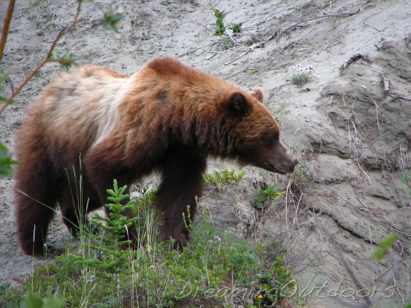 Grizzly Sight
The banger caught the bear's attention and he retreated to the top of the bluff. This bought us some time to figure out that we were blocking his passage along the trail which had funnelled both parties together. We stepped back into the marsh as he did something I didn't quite expect. He raised up on his hind legs, then pounded both front feet into the ground. He shook his head, started grunting, then looked directly at us and began to charge. Frozen, unable to move if I'd wanted to, we held our ground and he arrested his charge at 10 meters away. He then took notice of my clean pots which I'd dropped to thread my banger, and we slowly rotated around him at a 10 meter radius while he began to lick them.
Once at the top of the bluff, we were joined by a wide-eyed Alana and we filled her in. We hurried up towards camp to pack and leave before the bear tired of my pots. I've never packed so fast. We waited impatiently for everyone to finish packing, and walked until 11:30, finding another place to camp near an alluvial fan approximately 100 m off the trail at the 15 km mark. It was still windy and cold, and felt generally unfriendly.
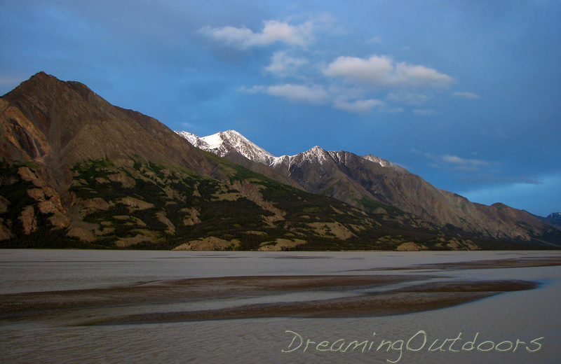 Midnight Sun
 Sunday, July 20, 2008
I didn't sleep well, waking often from the wind and the noises which accompanied it. It's fair to say I was a bit spooked. My hip was also aching because I didn't stretch after hiking. I was in a hurry to break camp. I would definitely not recommend camping between Boullion Creek and Canada Creek, where the alluvial fans funnel both bears and humans into inevitably close contact.
We hit the uphill section just as the effects of a bad Indian buffet were beating Troy into submission. So it was slow going as his intestines were curry-whipped the whole way. Once arriving at our destination, we found a perfect campsite on a rise overlooking the whole valley. The wind was still cold and strong, but we had faith in a forecast that called for better weather tomorrow.
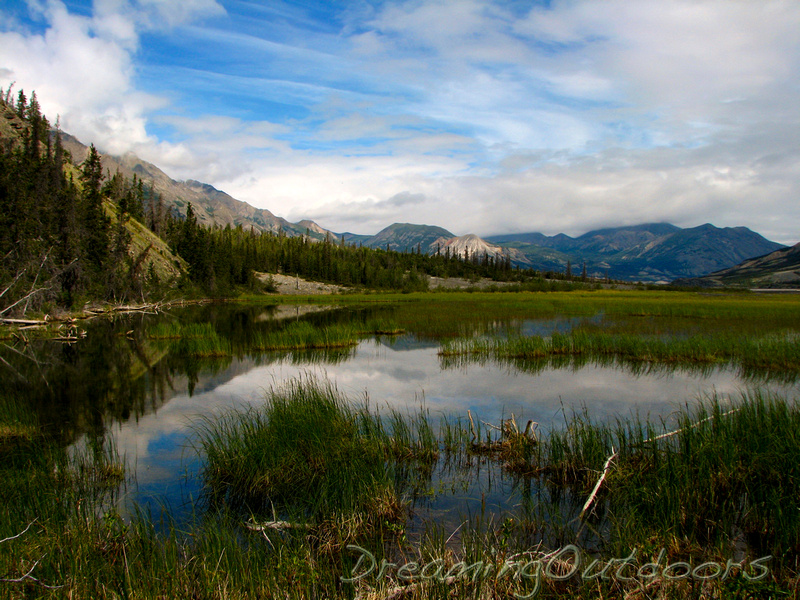 Slims Marsh
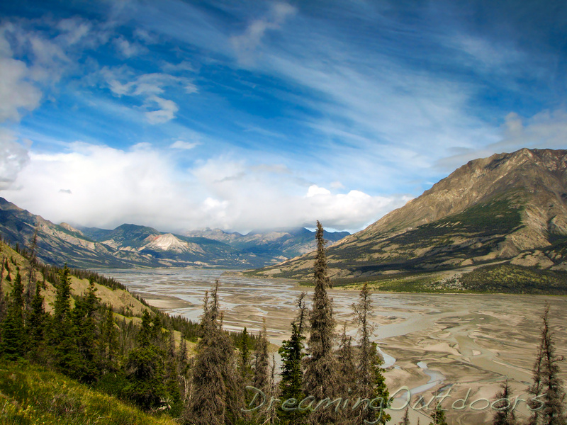 Slims Valley
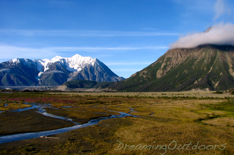 Canada Creek
Monday, July 21, 2008
We woke to windy conditions. It was sunny, but a low cloud shrouded Observation mountain and was not lifting or changing while we ate breakfast. We hit the trail around 10:00 am. We stuck close to the north bank, figuring a direct route was worth a deeper ford. As it turned out, there was no problem crossing the braids higher up Canada Creek. It was a long, rocky walk up the creek to its confluence with Columbia Creek. Views continued to improve up the valley until we reached a white rock with a small cairn on it.
Here we started up the steep slope. It was a long, relentless climb for me, especially since I was carrying a large pack with food and extra clothes. If weather conditions had been poor, we would have been thankful for it, but as it turned out it was just extra weight. There was very little exposure, and the narrow sections were relatively sheltered from the prevailing northwest winds. One rise after another, we climbed from initially rocky terrain into softer footing which made for nice climbing.
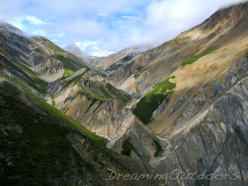 Serrated Valley
I started to fade pretty hard near the top of the plateau, at which point I looked ahead to see Alana crest a rise, stop, and put her hands in the air. Troy soon followed suit. Another bear, there was no mistaking, and I could barely stand up. They headed back down to my position, wide-eyed as they described the size of this one who, fortunately, was not bothered by our presence. We skirted around the bear further down the slope, coming around the plateau at a lower elevation.
I followed them around the other side so we were looking across the gully to the plateau on the other side. I stumbled and crashed; I simply didn't have enough sugar to stand up. We rested for a couple minutes while I ate a meal replacement bar. It was the oddest sensation; I've never been so hypoglycemic, and I could quickly feel myself returning to life.
From here, it became a glorious walk across the high plateau, soft ground cover sinking below our feet. The distant peaks of the St. Elias range became increasingly present, like jagged suns lifting from the horizon to reveal their snowy rays. Finally, the south arm of the glacier, then the north, then the confluence. We arrived under magically clear skies and the view was breathtaking. We left the large pack at the base of the climb up Observation Peak, and spotted some mountain goats up towards the summit. It was a steady but easy climb because of the soft footing. Upon reaching the false summit, we could see down the Kaskawulsh valley, and follow the glacier from its toe, up the confluence and both arms towards Mt. Logan, lost in the clouds.
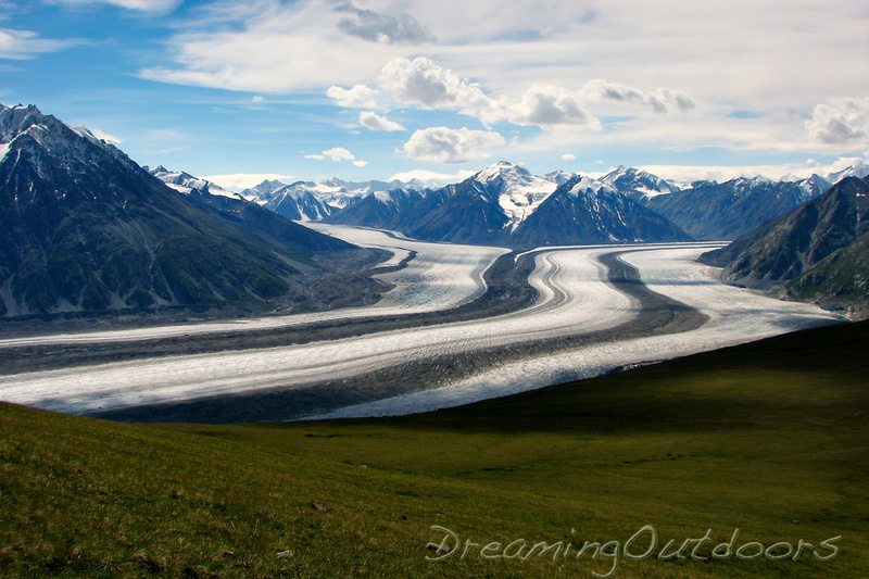 Kaskawulsh Glacier
We looked down to the meadow, spotting the distant figures of the four people from Juneau we had camped with the previous evening. Lingering in the icy wind for just long enough to drink in the views and take some pictures, we began our descent. It was a fun, easy descent to the plateau and we were careful as we approached each rise, half expecting to encounter the large brown grizzly that we'd seen earlier. We didn't encounter the other group, which made me wonder if they'd been turned back by the bear.
The way down was easier than I expected. The worst part was tediously crossing the rocky river flats back to camp. We caught up to the Alaskan group and it turned out they were unable to get around the same bear we encountered and unfortunately didn't get to see the glacier view.
Tuesday, July 22, 2008
The route out was incredibly fast. We were able to keep to the flats, as the mud had dried sufficiently, which cut hours off our day. We had a sighting of the bad grizzly up on an alluvial fan 100 m to the west of us. He watched us but continued in the opposite direction. Otherwise, the hike was swift and uneventful. We stopped for a snack at the location of our troublesome encounter, and I recovered my slightly damaged pot and pan. Back to Haines Junction in time to load up with food at the grocery store.
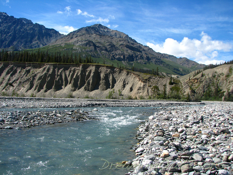 Slims Tributary
 After all was said and done, this was a remarkably memorable trip. Thanks to all who made it possible.
Slims River