This trip started out as our back-up plan after I was unable to secure backcountry permits to my first choice. I had previously talked with Clayton about the idea of returning to Michele Lakes; I've always thought it was one of the prettiest places on Earth and wanted to take Erin there. We got Darren and Steve to join us and we all met up the night before at Thompson Creek campground. The idea was to try to do the loop from Owen Creek to Sunset Pass, part of the Caribou section of the Great Divide Trail.

Day 1: Owen Creek Trailhead to Michele Lakes
Distance: 13.2 km
Elevation gain (to unnamed pass): 1060 m
Elevation loss (to Michele Lakes): 125 m
After some car shuttling between trailheads, we started up the beautiful Owen Creek canyon. It had changed since I was there 3 years ago though; a controlled burn had led to more deadfall and the trail was quite overgrown in places. We made slow progress up the gully and having my dog on a leash around my waist made for a few headaches... I actually had to carry him at a couple points.

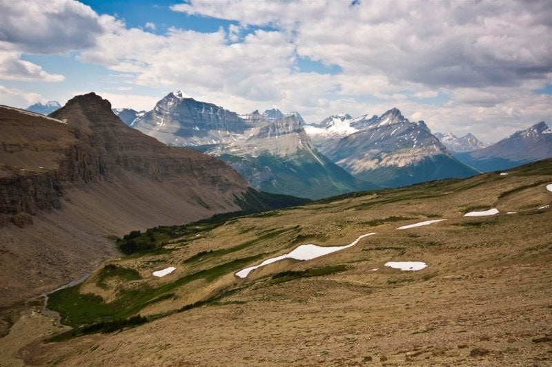
Once we finally made treeline, the smoke from the B.C. forest fires was obscuring an otherwise beautiful view. We made the slow slog up the unnamed pass to 2460 m as the group spread out.

The descent was soggy through the flood plain above the lakes and the mosquitoes started to get miserable. Clayton, Erin, and I cooked dinner above the upper lake while Darren and Steve proceeded to find a camp spot between the two lakes. It wasn't an easy 13.2 km and we pretty much went right to bed.
Day 2: Michele Lakes to Sunset Pass
Distance: 18.5 km
Elevation gain: 1010 m
Elevation loss: 1150 m
As day broke, I poked around the area taking photos. I climbed the moraine to the south for a better vantage. It was much clearer but the small amount of smoke in the air made for some nice colors with sunrise. It was day two and the dog was still on a leash and hadn't caused any havoc.
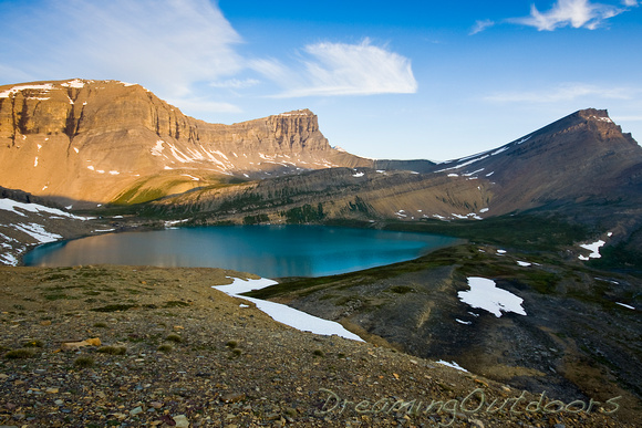
Lower Michele Lake hanging above a precipitous drop:
 First Light
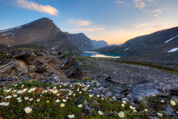
Wildflowers were in full bloom.
 My Michele
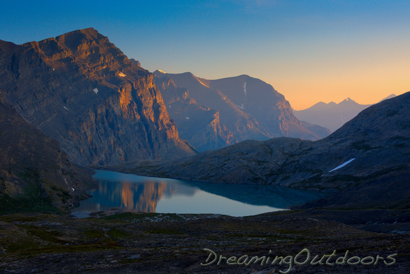
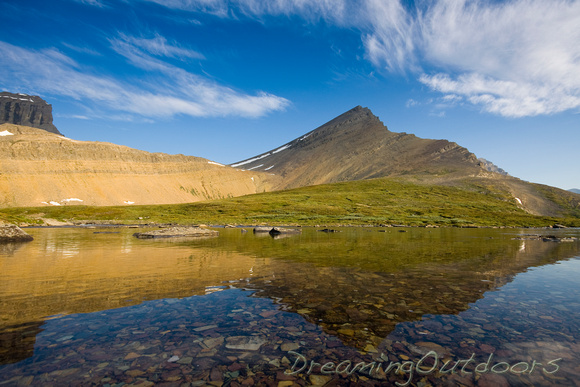
Alpenglow on the impressive rockwall above the upper lake.
 Upper Michele Lake
Our camp situated in the meadows between the two lakes.
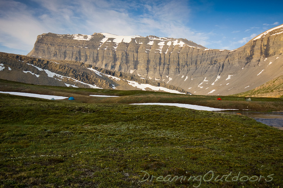 Camping in Paradise
 Still Waters
Cascades at the outflow of the upper lake.
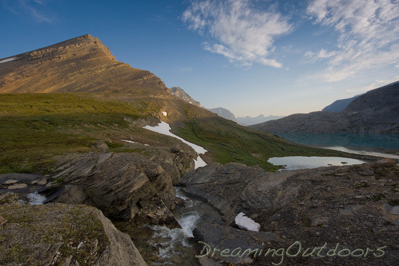 Paradise
The sun started to come out and it got quite warm by mid-morning. After some deliberation, Darren and Steve chose to head back down Owen Creek while Clayton, Erin and I decided to continue on the loop. Immediately after reaching the floodplain above the lakes, we began the ascent of the next unnamed pass with the hot sun at our backs. At the top of the highest pass on the GDT, 2590 m, the views were magnificent.

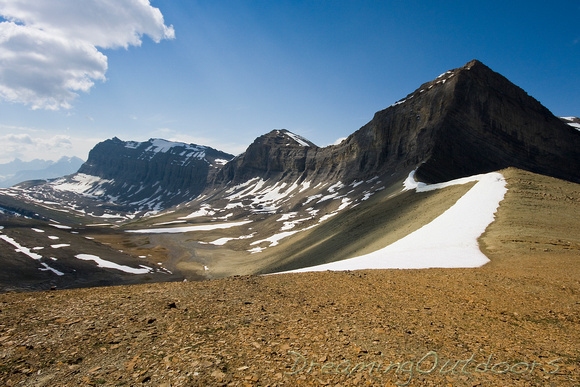 Unnamed Pass
Descending into Waterfalls Valley, looking across to the next pass to climb.
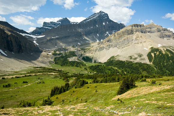 Waterfalls Valley, Bighorn Backcountry, AB
With every step down, we knew we were going to have to take another step up in an hour or so. We ended up descending too soon once over the pass; it would have been easier to traverse high across the first drainage and then drop down to the valley.
Waterfalls Valley was serene. We descended a gully where we could spot a trail clearly on the other side, angling up a bench to the next pass.

Here we are on the north side, looking back to the previous pass from Michele Lakes. The second photo is looking down the Waterfalls Valley towards the Cline river.


Cresting the second pass at 2460 m, we could look ahead to Cataract Valley, Huntington Valley, and Sunset Pass. This was a broad, rolling pass with flowers in full bloom. Despite the mid-day temperatures and a nice breeze, the mosquitoes tormented us through the alpine.
We spotted our next campsite on the alpine ledges just below the top of Sunset Pass.

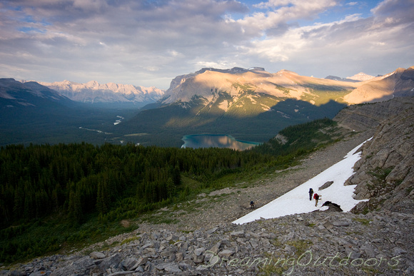
Here we begin the long descent to Pinto Lake, looking back to the pass we just gained. It felt unusual to have an actual trail to follow.
It was a tedious walk through the trees from the previous pass. The trail circles Pinto Lake counter-clockwise, passing by the Trees of Renown, until you reach the Pinto Lake campground. We forded the river at the outlet, cooked supper by the lake, then continued up to Sunset Pass under light showers.
From the campground, the trail follows the river downstream for a few hundred meters; where the river braids on your right and a small clearing emerges on the left, the trail to Sunset Pass turns left into the trees. There are some primitive bridges across the Cline at this point.
The trail is in excellent condition through the trees as it switchbacks up the slope. Finally we had some views down the valley as we crossed a few avalanche slopes. The last section up to our intended campsite took us through a small break in the cliff band.
 Reaching Camp
This was another beautiful campsite. On a protected alpine bench with protective cliffs above, it overlooked the Cline River Valley and Pinto Lake. Unfortunately, a spring that was there a couple years ago had dried up so there was no water source. This wasn't a concern since we had packed up water in the event this spring had dried up.
Day 3: Sunset Pass to Trailhead
Distance: 8.2 km
Elevation loss: 700 m
It poured overnight which made for a cozy sleep. The sun broke through the mist in the morning for long enough to dry out our tents and allow us to break camp.
We got wet through the willowy meadows even though it wasn't raining, and it did start drizzling once we were in the trees. It was a very quick exit on the last day, which left us with lots of time to stop for pizza in Rocky Mountain House before parting ways.
The scenery was amazing on this trip, and seemed amplified by remoteness of the area. We saw only a couple fishermen at Michele Lakes who were dropped off by helicopter, and ran into two hikers at Pinto Lake who had come down Cataract Creek. They seemed glad to have a bit of help finding the trail up to Sunset Pass and they ended up camping with us that night. Not bad for August long weekend in the Rockies. Thanks guys!
Great Divide Trail
